from 0 review
8
Up to 30 days
Unlimited
___
Overview
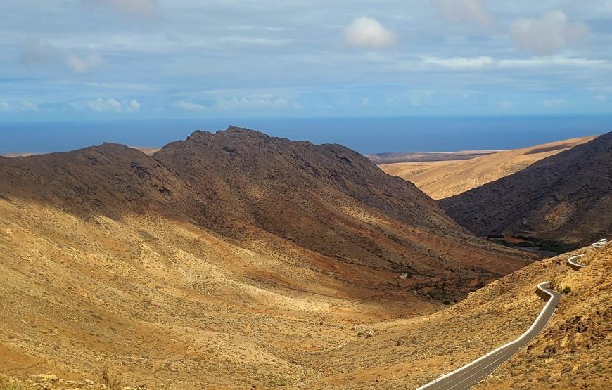
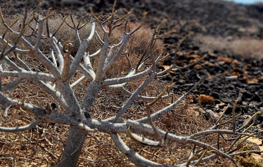
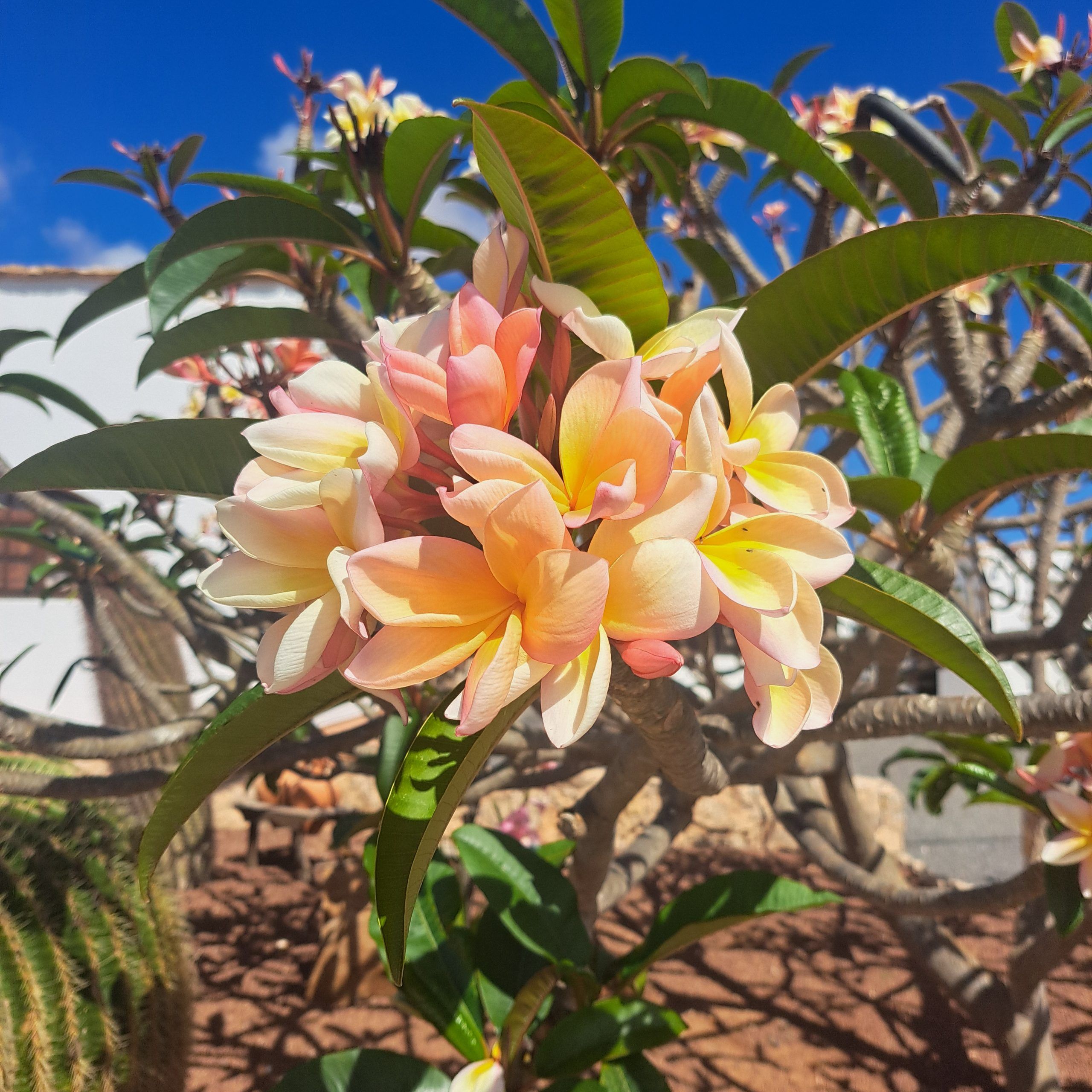
Fuerteventura is the second largest island of the Canary Islands and was declared a Biosphere Reserve by UNESCO on May 26, 2009. It is also the largest of the Canary Islands, from end to end. The vastness, the mountains and the soft shapes of the sea sand form a unique combination. Beautiful landscapes, with round shapes and light colors, with a spectacular turquoise sea and white beaches as a backdrop. While walking the GR131 hiking Fuerteventura you will enjoy great views and a special landscape.
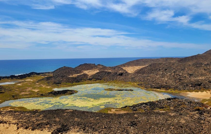
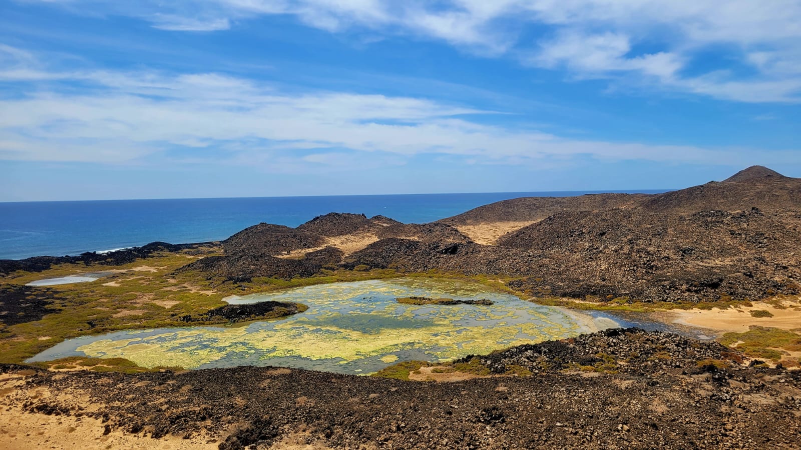
The island is rich in protected nature reserves, most of which you can admire along the way. While hiking Fuerteventura you will discover, for example, the Islote de Lobos Natural Park, the natural monument Malpaís de la Arena and its associated lavas, the last volcanic remains on the island, the “sacred” mountain of Tindaya, an iconic place for the majos (the residents of Fuerteventura and Lanzarote), the Betancuria Rural Park, the largest natural area on the island, with its landscape of “U”-shaped ravines, the Cardón Natural Monument and of course, in the far south, the Jandía Natural Park.

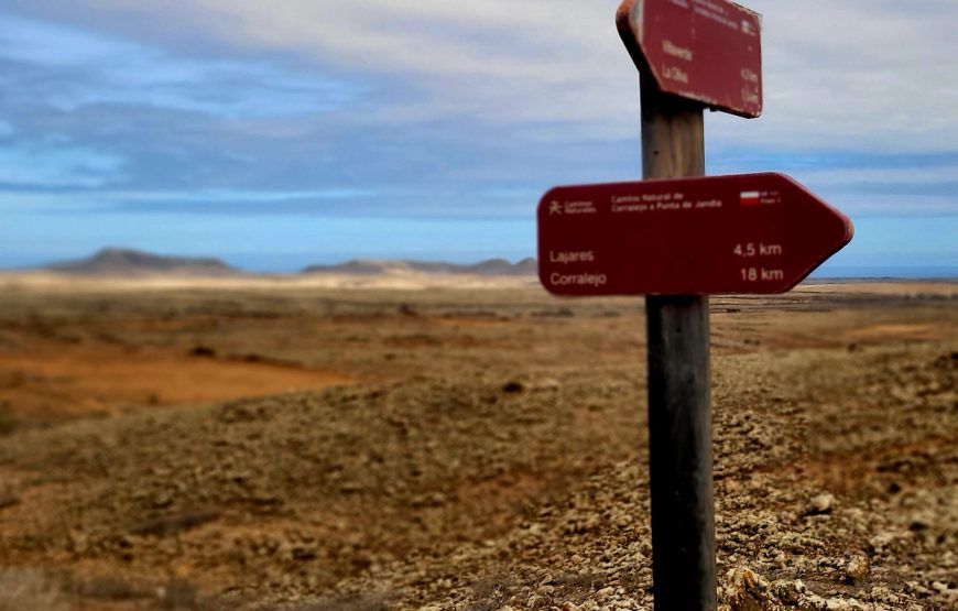
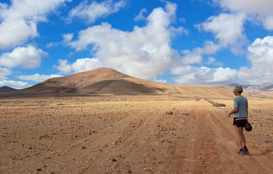
The GR131 is a long-distance hiking trail that runs through all the (large) Canary Islands. The total route is approximately 560 km long. Starting on Lanzarote (75 km), the GR131 then takes you past Fuerteventura (164 km), Gran Canaria (74 km), Tenerife (101 km), La Gomera (46 km), La Palma (70 km) and El Hierro (40 km). km). The route is excellently signposted. Every 100 meters you will find a sign showing the direction and the number of kilometers to the next village. So you don’t have to be afraid of getting lost. There are not many hikers who hike the GR131 Fuerteventura. So are you looking for peace and quiet? Then hiking Fuerteventura is ideal for you!
It is good to know that the combination of the lack of trees (and therefore shade!) and the desert and arid climate of the island, with the lack of rain and almost constant temperatures above 20 ºC all year round, you forces you to take good care of yourself. So remember good protection against the sun and take enough water with you for the journey.

Today your hiking adventure starts on the GR131 Fuerteventura. After arriving at the airport you take the bus or taxi to Corralejo. Corralejo is a charming coastal town with wonderful beaches. Here you can recover from the journey. And get ready for the first walk tomorrow.
From the port of Corralejo you leave by boat to the island of Lobos. It is a kind of water taxi that leaves every half hour and a return ticket costs 15 euros per person: https://www.barracudafuerteventura.com/excursiones/water-taxi-isla-de-lobos. The crossing itself takes 5-10 minutes. Hold on tight!
Once on the island of Los Lobos you will immediately see the signage of the GR131 Fuerteventura. There is also a small visitor center with information about the island.
The advice is to start the hiking Fuerteventura on the island towards the lighthouse. Along the way you pass the remains of the volcano. Climbing the volcano looks worse than it actually is. You go up gradually with steps. From the highest point you have beautiful views of Lanzarote and Fuerteventura. You descend and continue your walking route towards the lighthouse. From the lighthouse you take the route back along the other side of the island. Then treat yourself to delicious fresh fish in the only restaurant on the island. You can also take a dip from Playa Loncha. And then take the water taxi back to Corralejo. Your first day is over…

Today you leave Corralejo and the first stage of the GR131 hiking Fuerteventura takes you to Villaverde. From the center of Corralejo you quickly enter the volcanic nature that makes the island so unique. Halfway you pass Lajares. Here you can enjoy a cup of coffee and buy water for the 2nd part of the stage.
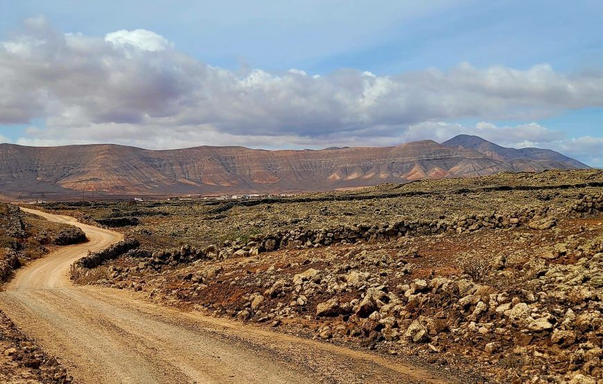
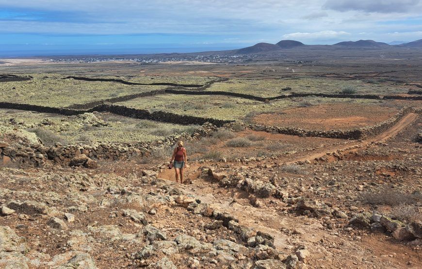
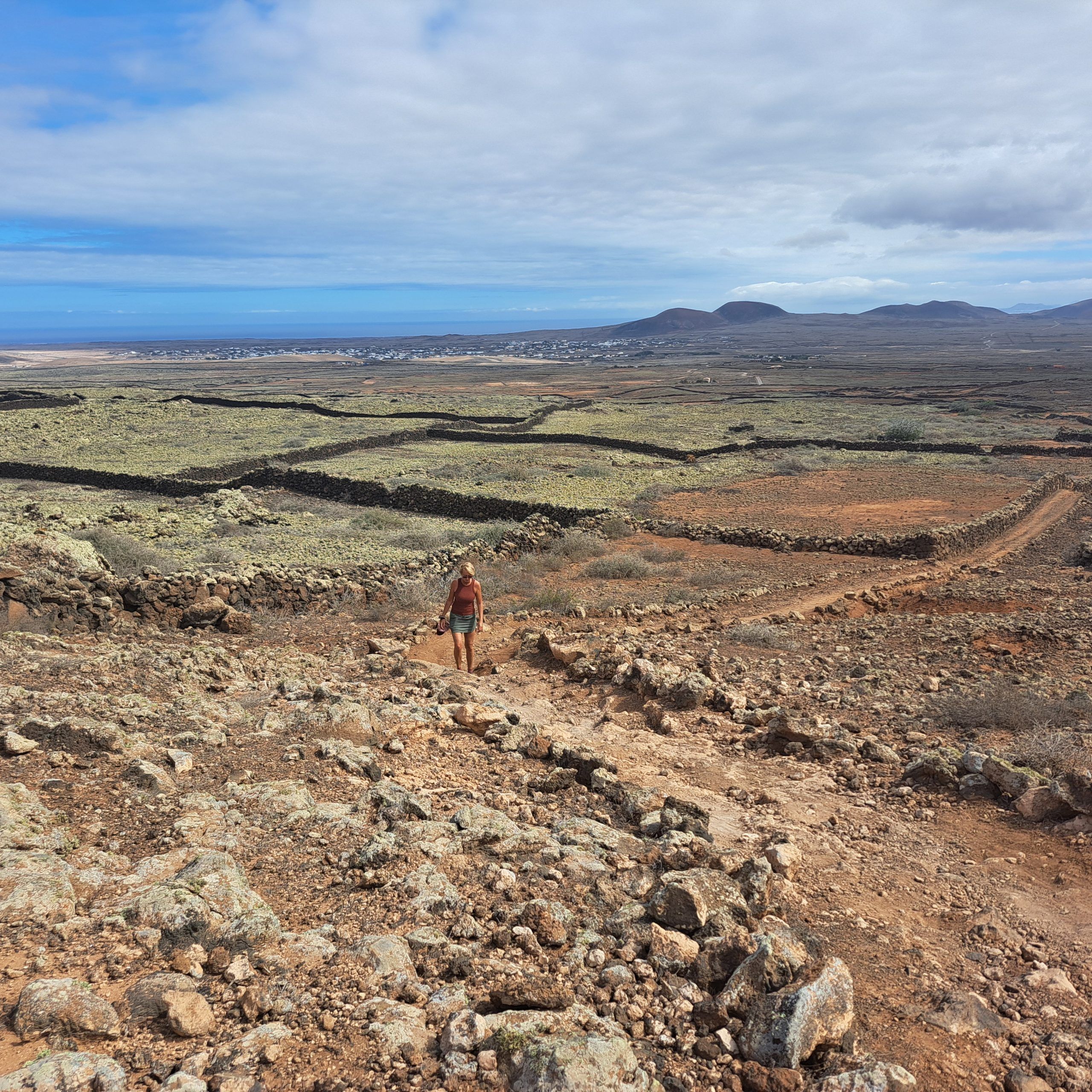
The route of the GR131 hiking Fuerteventura is well indicated with arrows or the red-white marking you will find painted stones along the route. You slowly climb further up. Don’t forget to look back every now and then and enjoy the views of the sea and the volcanoes. When you are at the highest point, you can already see your final destination for today, Villaverde, in the distance. With a beautiful volcano in the background. Villaverde is located in the middle of nowhere. On the way there you only hear your own footsteps. Rocks covered with green moss lead you further down the road.

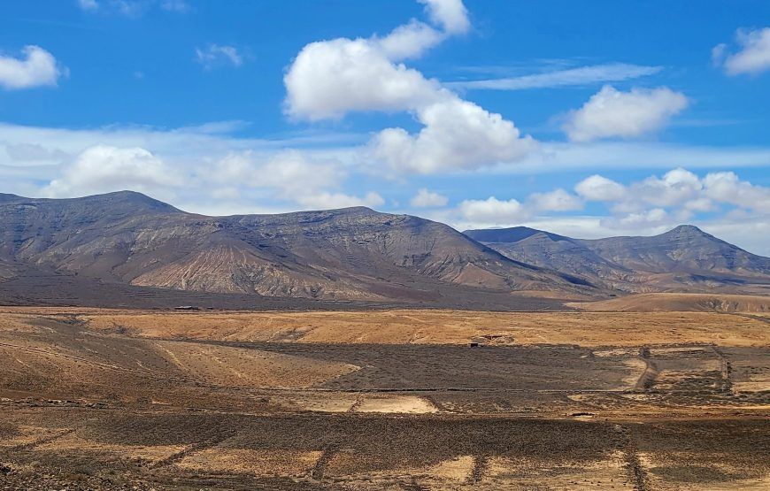
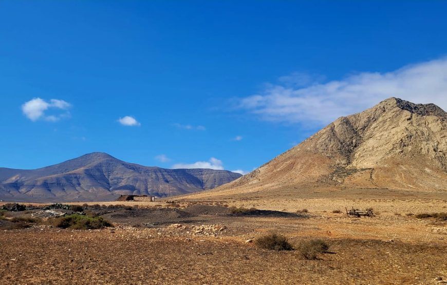
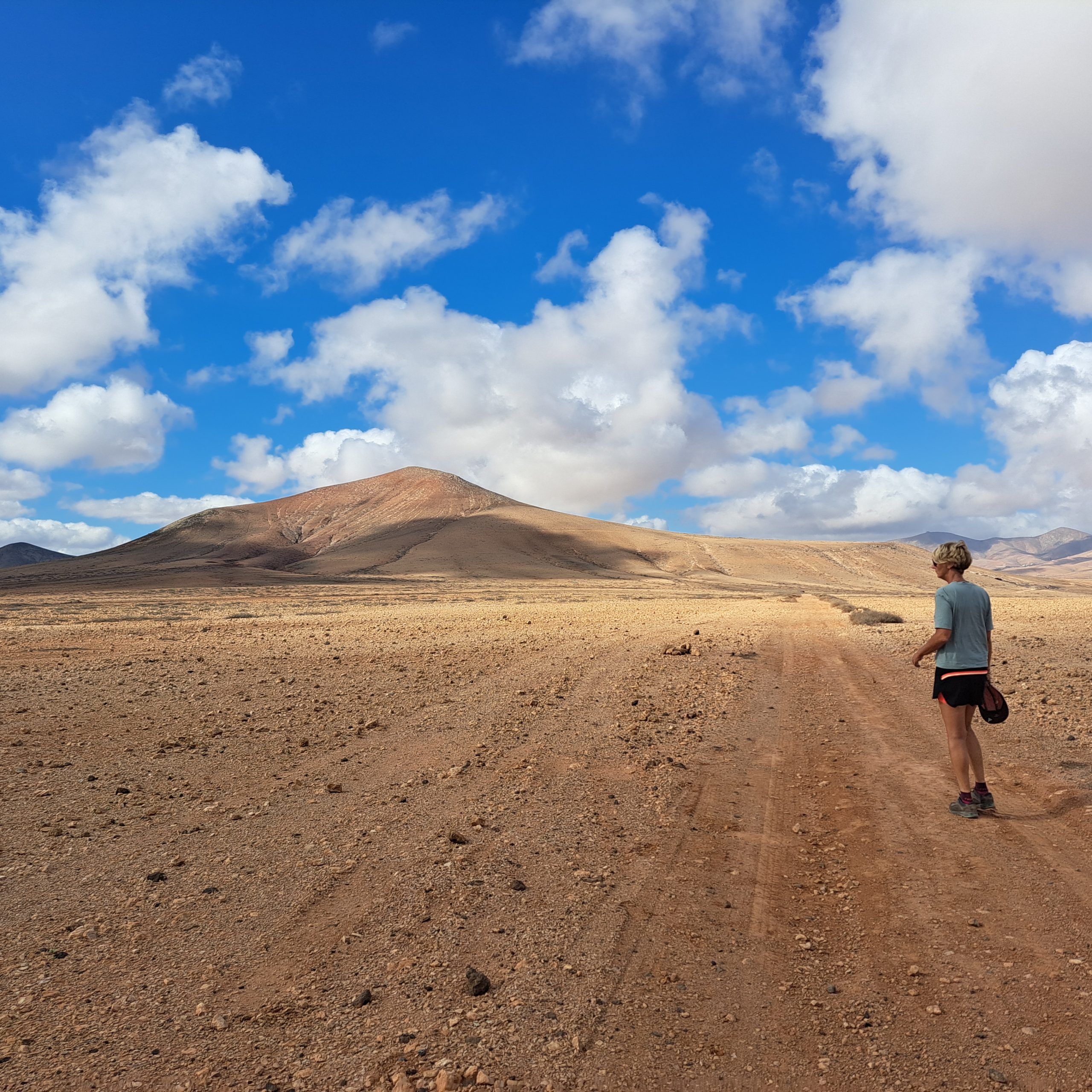
This stage of the GR131 hiking Fuerteventura takes you past the legendary Tindaya Mountain, a sacred place for the island’s original inhabitants. You have a view of this mountain from your departure in Villaverde. You’re getting closer. You can make another coffee stop in Tindaya. Then you cross the beautiful plains of the Tablero Blanco and the Tablero de las Avutardas. Along the way you will pass the statue of writer Miquel de Unamunoom. A Spanish writer who was exiled to Fuerteventura because of his controversial statements. In Tefia it is worthwhile to visit the San Agustín de Tefía, a small church.

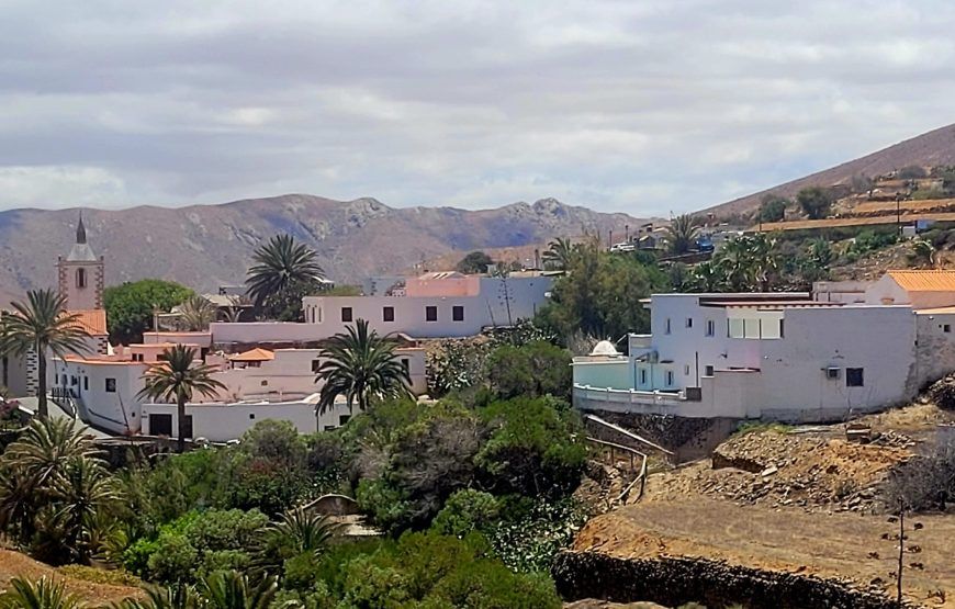
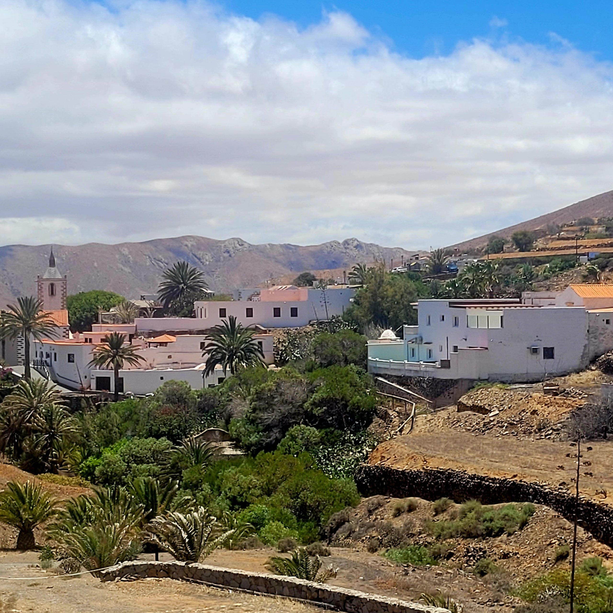
From the church in Tefía you continue today on the GR131 hiking Fuerteventura towards the historic capital of the island, Betancuria, founded in 1404 by Jean de Bethencourt, a Frenchman. Betancuria belongs to the ‘Pueblos mas bonitos de España’, or Betancuria is one of the most beautiful villages in Spain. Along the way you will pass some windmills that you see in various places on the island. This is where the GR131 hiking Fuerteventura meets the route to La Pena. Every year, on the 3rd Sunday in September, many residents of the island walk this route to La Pena, the patron saint of the island.
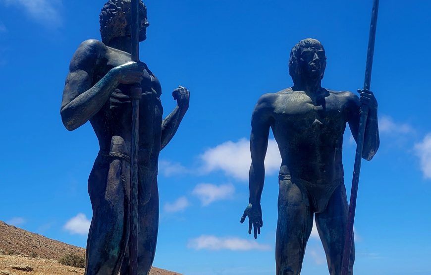
Before you reach Betancuria you have to cross the Bermeja mountain. That’s quite a climb! At the top. you will find the statue of Guise and Ayose. They were the kings of Lanzarote before the Europeans arrived. You also have a beautiful view of your final destination today. Betancuria is located in the middle of greenery and you will even find palm trees there. And that is special to see in this volcanic landscape.

From Betancuria you have two options. The official GR131 hiking Fuerteventura goes up a bit and then descends again. But you can also follow the riverbed. This part is indicated as the Camino de Pena. That is completely flat and also slightly shorter, about 1 km.
Whichever variant you choose, the route meets again at the church in Pena, as mentioned, the patron saint of the island. The church is open daily from 10:30 am and is worth a visit. This variant through the riverbed is also slightly shorter, 1 km. After la Pena there is another climb. The path of the GR131 hiking Fuerteventura is rocky. And there can be a strong wind. If you think you are there when you arrive at the road ahead of the cars, you are wrong. You climb even further. From the highest point you descend to Toto and then follow the riverbed to Pajara.
From Pajara a transfer will take you to Costa Verde for the overnight stay.

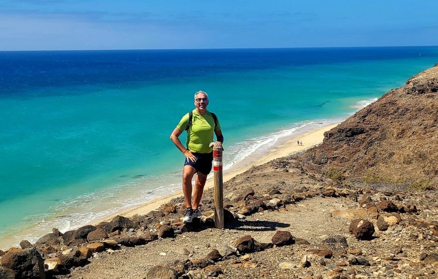
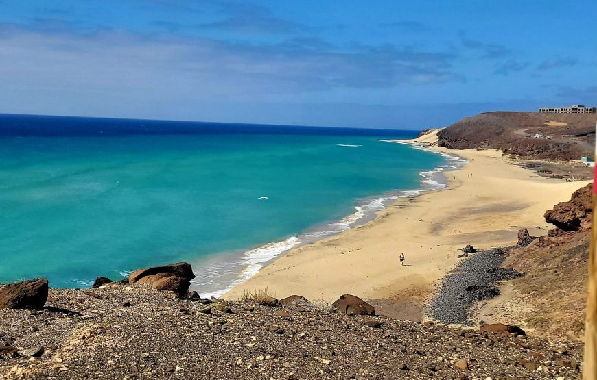
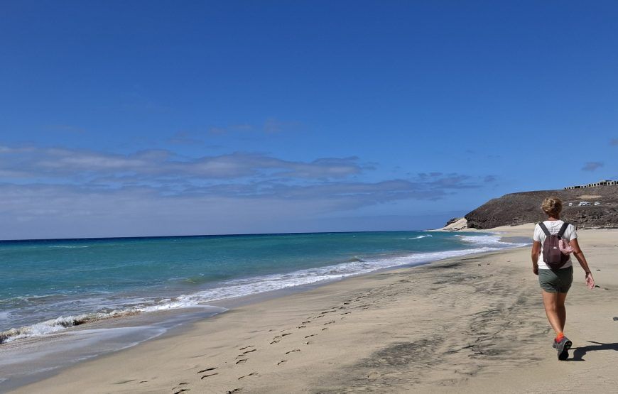
Today the last stage of the hiking Fuerteventura is planned. And what kind! Do you remember? A few days ago you started on the north coast. Today your stage ends on the west coast of the island. Along the way you will come across the most beautiful beaches and the water is bluer than blue. Playa Salmo stands out! In one of the beach bars you can have a delicious coffee along the way or perhaps even take a dip. The blue water is almost impossible to resist…
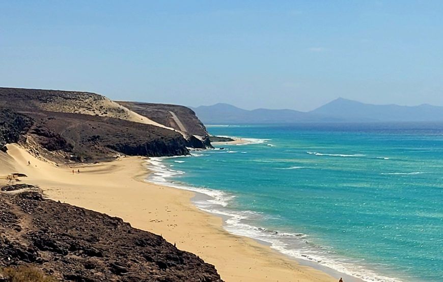
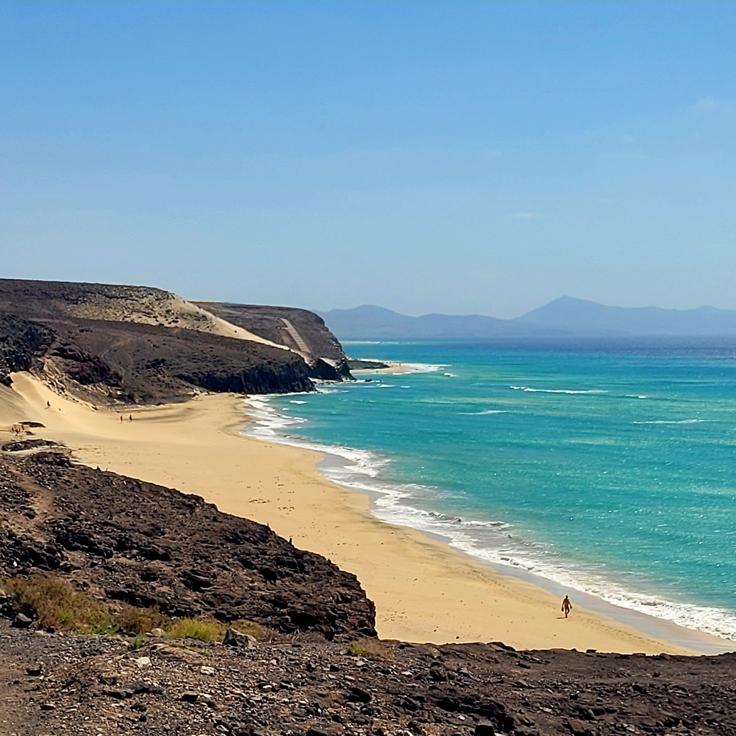
The hiking Fuerteventura follows the coastline here and sometimes you even walk on the beach. In some parts you have to pay close attention to the directions of the route, but if you continue to follow the coastline you will see the well-known red and white markings of the GR131 hiking Fuerteventura,
Your final destination is the lighthouse of Morro Jable. Your hiking adventure in Fuerteventura ends here!

With a transfer you go to Fuerteventura airport. But maybe you would like to stay on the island longer and enjoy the beach for a few more days? Or discover even more of the island with a rental car? Ask us about the possibilities.
Do you want to start the GR131 in Lanzarote? During this 8-day GR131 hike on Lanzarote you will discover the volcanic wonders of this island, pass authentic villages, admire the unique architecture of César Manrique, enjoy the panoramic views and watch the waves crash against the rocks. Thanks to the red-white markings of the path called ‘Camino Natural’, you can walk the entire route on mainly unpaved paths. Enough time to enjoy the panoramic views, the enchanting volcanic landscapes, surreal craters, unusual vineyards, delicious gastronomy and the lively cities along the way.
Today your hiking adventure starts on the GR131 Fuerteventura. After arriving at the airport you take the bus or taxi to Corralejo. Corralejo is a charming coastal town with wonderful beaches. Here you can recover from the journey. And get ready for the first walk tomorrow.
From the port of Corralejo you leave by boat to the island of Lobos. Once on the island of Los Lobos you will immediately see the signage of the GR131 Fuerteventura. There is also a small visitor center with information about the island.
The advice is to start the hiking Fuerteventura on the island towards the lighthouse. Along the way you pass the remains of the volcano. Climbing the volcano looks worse than it actually is. You go up gradually with steps. From the highest point you have beautiful views of Lanzarote and Fuerteventura. You descend and continue your walking route towards the lighthouse. From the lighthouse you take the route back along the other side of the island. Then treat yourself to delicious fresh fish in the only restaurant on the island. You can also take a dip from Playa Loncha. And then take the water taxi back to Corralejo. Your first day is over...
Today you leave Corralejo and the first stage of the GR131 hiking Fuerteventura takes you to Villaverde. From the center of Corralejo you quickly enter the volcanic nature that makes the island so unique. Halfway you pass Lajares. Here you can enjoy a cup of coffee and buy water for the 2nd part of the stage.
The route of the GR131 hiking Fuerteventura is well indicated with arrows or the red-white marking you will find painted stones along the route. You slowly climb further up. Don't forget to look back every now and then and enjoy the views of the sea and the volcanoes. When you are at the highest point, you can already see your final destination for today, Villaverde, in the distance. With a beautiful volcano in the background. Villaverde is located in the middle of nowhere. On the way there you only hear your own footsteps. Rocks covered with green moss lead you further down the road.
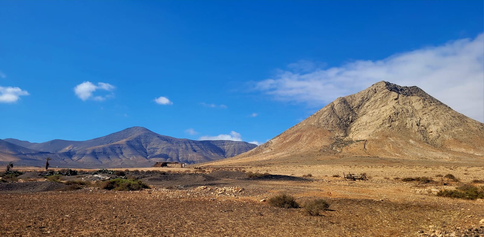
This stage of the GR131 hiking Fuerteventura takes you past the legendary Tindaya Mountain, a sacred place for the island's original inhabitants. You have a view of this mountain from your departure in Villaverde. You're getting closer. You can make another coffee stop in Tindaya. Then you cross the beautiful plains of the Tablero Blanco and the Tablero de las Avutardas. Along the way you will pass the statue of writer Miquel de Unamunoom. A Spanish writer who was exiled to Fuerteventura because of his controversial statements. In Tefia it is worthwhile to visit the San Agustín de Tefía, a small church.
From the church in Tefía you continue today on the GR131 hiking Fuerteventura towards the historic capital of the island, Betancuria, founded in 1404 by Jean de Bethencourt, a Frenchman. Betancuria belongs to the 'Pueblos mas bonitos de España', or Betancuria is one of the most beautiful villages in Spain. Along the way you will pass some windmills that you see in various places on the island. This is where the GR131 hiking Fuerteventura meets the route to La Pena. Every year, on the 3rd Sunday in September, many residents of the island walk this route to La Pena, the patron saint of the island.
Before you reach Betancuria you have to cross the Bermeja mountain. That's quite a climb! At the top. you will find the statue of Guise and Ayose. They were the kings of Lanzarote before the Europeans arrived. You also have a beautiful view of your final destination today. Betancuria is located in the middle of greenery and you will even find palm trees there. And that is special to see in this volcanic landscape.
From Betancuria you have two options. The official GR131 hiking Fuerteventura goes up a bit and then descends again. But you can also follow the riverbed. This part is indicated as the Camino de Pena. That is completely flat and also slightly shorter, about 1 km.
Whichever variant you choose, the route meets again at the church in Pena, as mentioned, the patron saint of the island. The church is open daily from 10:30 am and is worth a visit. This variant through the riverbed is also slightly shorter, 1 km. After la Pena there is another climb. The path of the GR131 hiking Fuerteventura is rocky. And there can be a strong wind. If you think you are there when you arrive at the road ahead of the cars, you are wrong. You climb even further. From the highest point you descend to Toto and then follow the riverbed to Pajara.
From Pajara a transfer will take you to Costa Verde for the overnight stay.
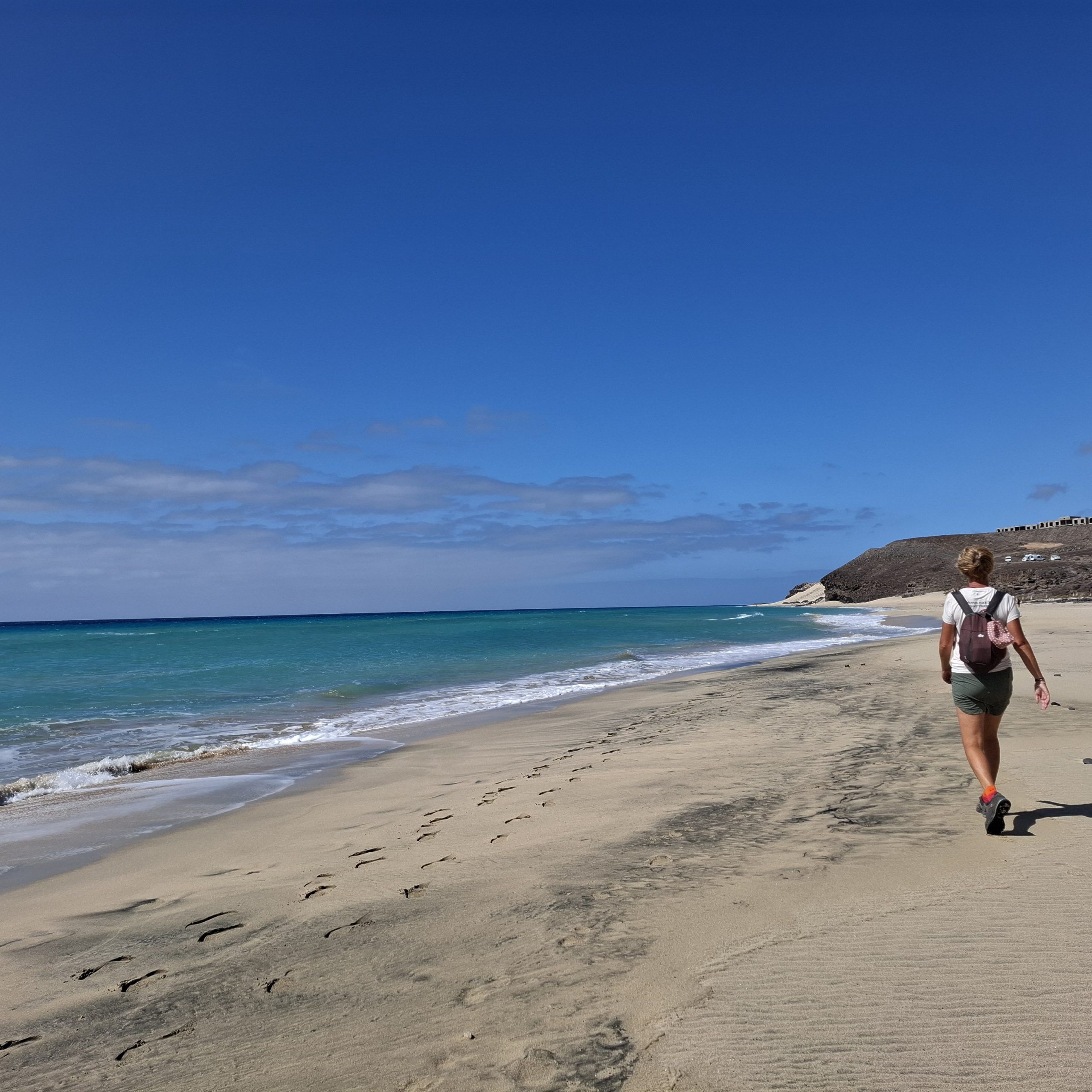
Today the last stage of the hiking Fuerteventura is planned. And what kind! Do you remember? A few days ago you started on the north coast. Today your stage ends on the west coast of the island. Along the way you will come across the most beautiful beaches and the water is bluer than blue. Playa Salmo stands out! In one of the beach bars you can have a delicious coffee along the way or perhaps even take a dip. The blue water is almost impossible to resist...
The hiking Fuerteventura follows the coastline here and sometimes you even walk on the beach. In some parts you have to pay close attention to the directions of the route, but if you continue to follow the coastline you will see the well-known red and white markings of the GR131 hiking Fuerteventura,
Your final destination is the lighthouse of Morro Jable. Your hiking adventure in Fuerteventura ends here!
With a transfer you go to Fuerteventura airport. But maybe you would like to stay on the island longer and enjoy the beach for a few more days? Or discover even more of the island with a rental car? Ask us about the possibilities.
The GR131 on Fuerteventura is moderately challenging. Daily distances range from 14 to 23 km, with terrain that is mostly open, rocky, and exposed. A good level of fitness and some prior hiking experience are recommended.
Yes! Your main luggage will be transported from accommodation to accommodation, so you only need to carry a daypack while hiking.
You’ll stay in a mix of comfortable guesthouses, boutique hotels, and rural fincas or casa rurales. All are chosen for their quality and local charm.
Breakfast is included daily. For lunch and dinner, you can enjoy meals at local restaurants or cafés along the route.
The GR131 is part of the Camino Natural network and is consistently marked with red and white trail signs that are easy to follow throughout the route.
The best months to hike Fuerteventura are October to May, when temperatures are more comfortable for long-distance walking.
Good hiking shoes, a daypack, sun protection, refillable water bottles, and layers for changing weather. Hiking poles are optional but helpful.
Your trip includes a transfer from Fuerteventura Airport to your first accommodation and back to the airport after the hike ends.
Expect to walk 14–23 km (8.7–14.3 miles) per day. The terrain is mostly open, rocky, and exposed, with long stretches of uninterrupted views and minimal shade.
Yes! You can pair this trip with the 8-day Lanzarote GR131 hike or choose the full 13-day combined itinerary that includes both islands.
Absolutely. We’re happy to help arrange extra nights before or after your hike so you can relax on the beach or explore more of the island at your own pace.
Member Since 2019


Leave a review